

Field surveys are a fundamental step in engineering studies, responsible for identifying and diagnosing the condition of pavements, which are essential for decision-making on projects for capacity expansion, rehabilitation, operation, maintenance, and conservation of highways.
Irregularity Survey (IRI/ATR)
The International Roughness Index (IRI) and Transverse Profile (ATR) is the sum of pavement irregularities in relation to a reference plane. These parameters are evaluated based on Highway Diagnostics (VDRs) or SCANLASER 3D. These vehicles are equipped with laser beams, accelerometers, and precision equipment for measuring speed, displacement, and position (GPS), which collect data sent to a laptop in real time, providing longitudinal (QI/IRI) and transverse (ATR) pavement profiles.
Survey of Surface Defects
There are several standardized methodologies for assessing surface defects in asphalt pavements: Objective Assessment of Defects (IGG) – DNIT 006/2003 – PRO, Detailed Visual Survey (LVD) – DNIT 007/2003 and Continuous Visual Survey (LVC) – DNIT 008/2003 – PRO, all using the terminology DNIT 005/2003 – TER. For rigid pavements, the DNIT 062/2004 – PRO standard and 061/2004 – TER terminology are used. To apply the aforementioned methodologies, VDRs or vehicles equipped with lasers and high-resolution cameras, precision distance meters, and a global positioning system (GPS) are used.
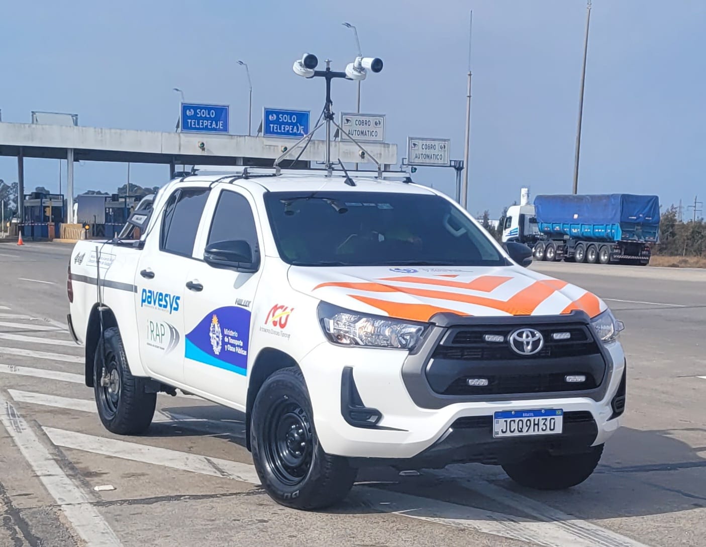
Detailed Visual Survey by scanning (LVD Pavesys)
Detailed Visual Survey by scanning (LVD Pavesys) is a proprietary methodology developed for the detailed assessment of flexible and rigid pavements, through the use of high-resolution cameras attached to a vehicle and a global positioning system (GPS), where the pathologies present in the pavement are cataloged as it moves along the highway. The pathologies present in the pavement are identified, classified by severity, and positioned in the traffic lanes, thus obtaining a more detailed picture of the surface condition of the pavement.
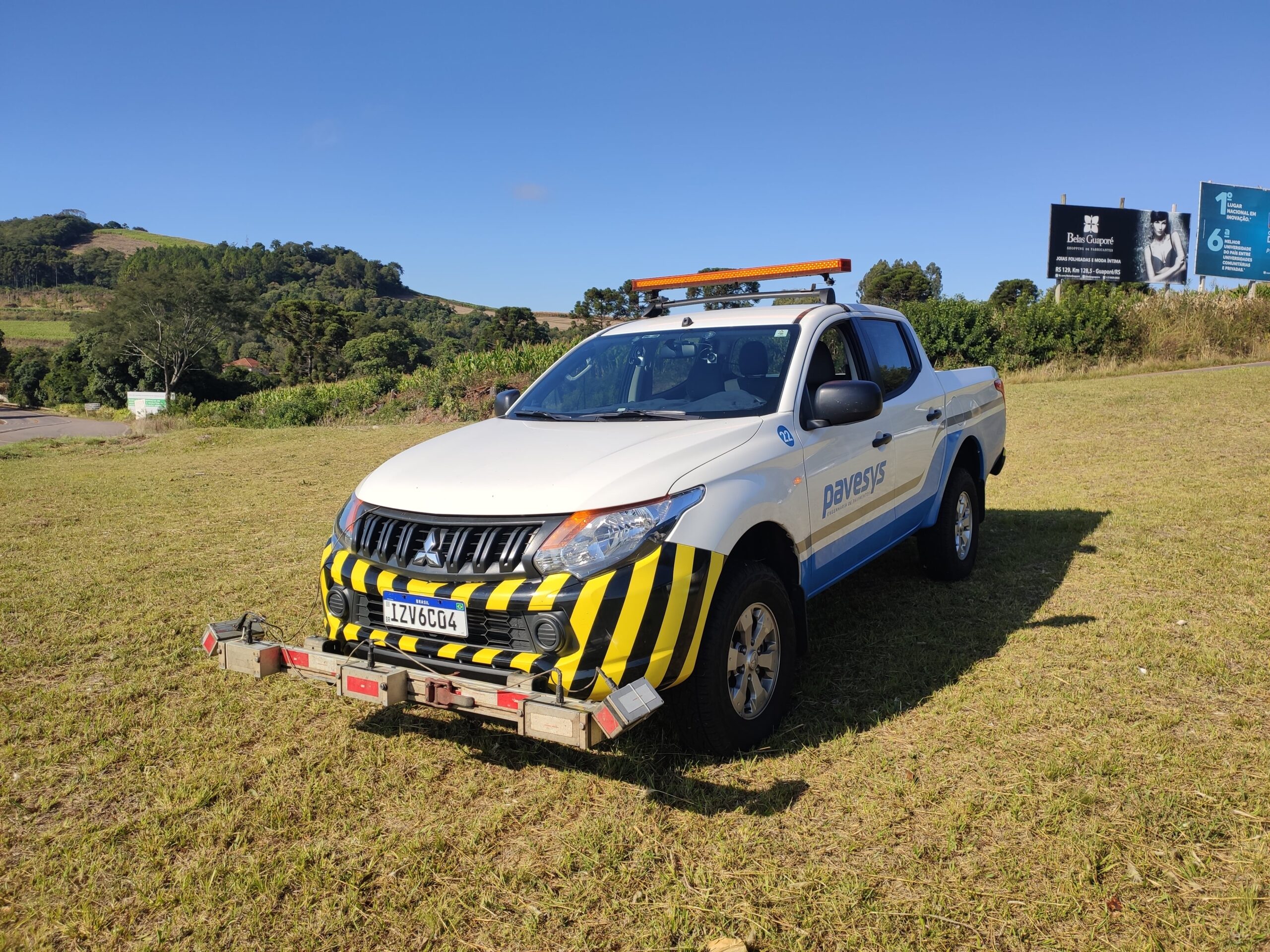
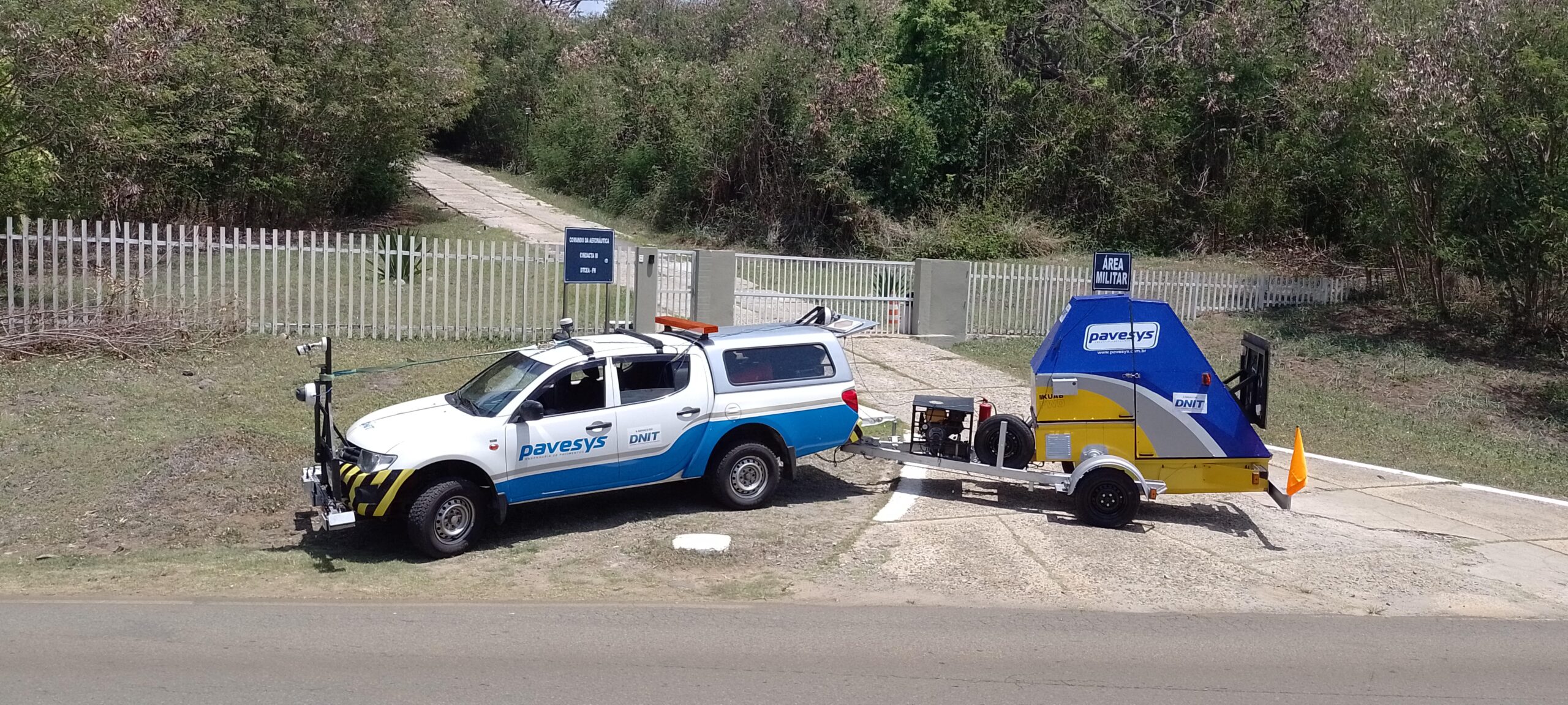
Deflectometric Survey (FWD/HWD)
The Deflectometric Survey by Impact is performed by FWD/HWD (Falling Weight Deflectometer) equipment and standardized by DNER 273 – PRO and ASTM D 4695 standards.
The survey consists of recording the deflectometer basin, applied load, air and pavement temperature, and geographic position (GPS) at each test point. The test consists of applying an impact load to a defined point and reading the displacements on several sensors placed at defined distances to obtain the displacement line. After reading, the results are sent to the control cabin for operator validation and then to the cloud for data processing in the office and report generation.
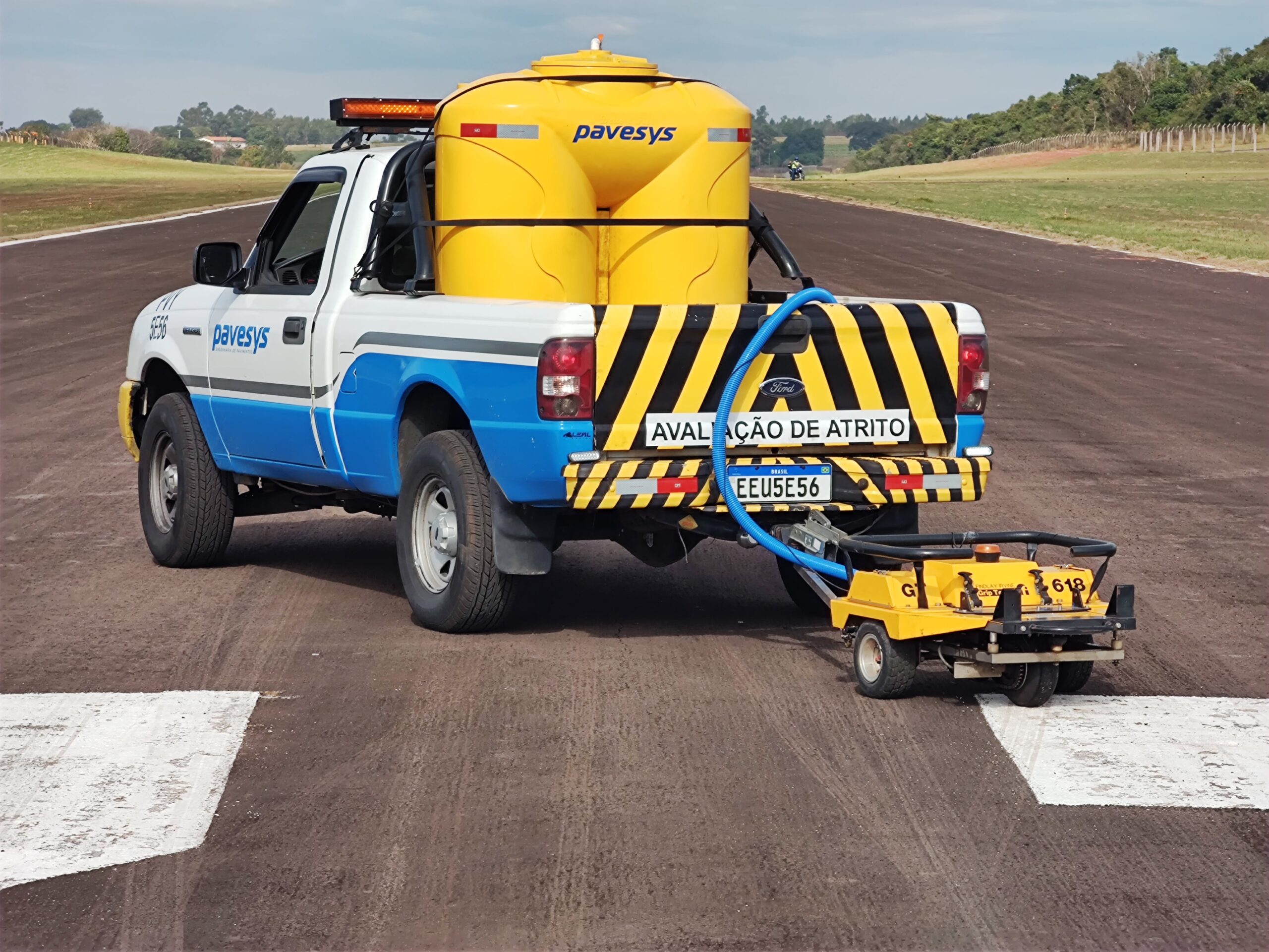
Tire-Pavement Adhesion Condition Surveys
These surveys consist of evaluating the microtexture and macrotexture of the pavement, either continuously or at specific points. Pavesys Engenharia has equipment for static/spot surveys: Sand Patch and British Pendulum, and equipment for dynamic/continuous surveys, the Grip Tester (microtexture) and MT Laser (macrotexture).
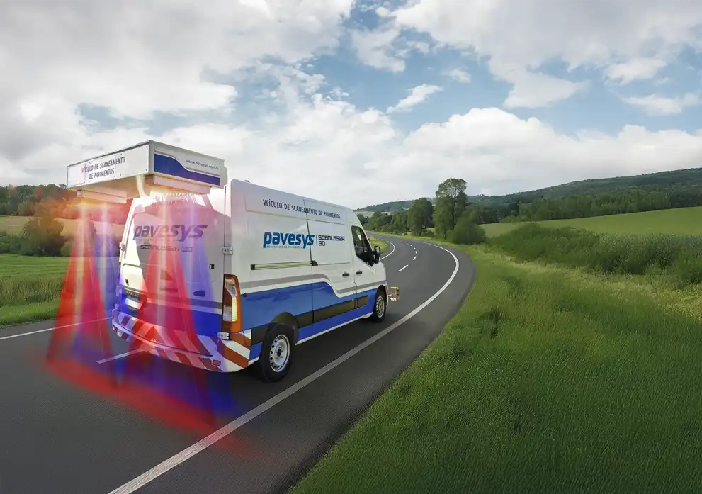
Integrated Pavement Condition Survey (SCANLASER 3D)
SCANLASER 3D combines two advanced systems: automatic defect detection by laser beam and imaging, and longitudinal (IRI) and transverse (ATR) irregularity surveys by high-resolution profilometer. With state-of-the-art sensors and operation at speeds of up to 100 km/h, it provides 3D data, high-resolution images, and technical parameters with millimeter precision and real-time georeferencing, optimizing pavement management and maintenance.
SCANLASER 3D combines the functionalities of the Laser Crack Detecting System and the Road Surface Profilometer (RSP), creating a complete system for detecting surface defects, irregularities (IRI and ATR), and pavement macrotexture conditions (safety).


